In this post Ralf B. Schäfer talks about the paper „Modeling global distribution of agricultural insecticides in surface waters“.
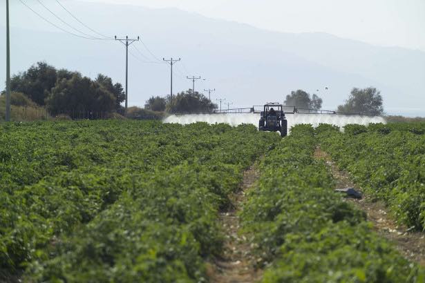
Pesticide spraying (photo: A. Künzelmann; UFZ)
Unlike other chemicals, agricultural pesticides are intentionally applied to the environment to help farmers control insects, weeds and other potentially harmful pests threatening agricultural production. They can therefore affect land ecosystems but also surface waters from runoff. According to estimates, ca. 4 million tons of agricultural pesticides are applied annually, equating to an average of 0.27 kilograms per hectare of the global land surface. Earlier investigations showed that pesticides can reduce the biodiversity of invertebrates in freshwater ecosystems by up to 42 percent (Beketov et al. 2013). The global application of pesticides in many developing countries may increase with farmers switching from traditionally extensive agricultural practices to more intensive ones. However, the global extent of the potential water pollution from the application of insecticides has remained largely unknown.
We therefore developed a global map of insecticide pollution with a raster resolution of approximately ten kilometres. The model relied on several global data sets including agricultural data from the FAO, land use data from NASA and annual average temperatures and monthly maximum precipitation measurements from around 77,000 weather stations. With the model we estimated the so-called runoff potential (RP), i.e. the amount of insecticides that enters streams and rivers through the rainwater from agricultural land. To test such a complex model, we compared the predictions to measurements of insecticide contamination in freshwater ecosystems from four different regions.
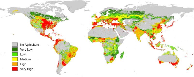
Global insecticide risk map (taken from publication)
Several world maps were produced: the vulnerability map only considers the geographic and climatic background. The hazard map on the other hand displays the human contribution to risks for water bodies, whereas the risk map is the final map and the sum of the vulnerability and hazard map. For Central Europe the risk for water bodies was medium to high. In the northern hemisphere, insecticide runoff presented an overall more significant latitudinal gradient. The risks of insecticide exposure to water bodies increased significantly along the North-South gradient in Europe, North America and Asia, mainly driven by a higher insecticide application rate as a result of higher average temperatures. Given that the economy and the population are growing rapidly in many countries of the southern hemisphere, a higher insecticide application rate can be expected in those countries in the future, to increase agricultural production. The risk could therefore change considerably. Currently, water bodies in the Mediterranean, the USA, Central America and Southeast Asia are particularly vulnerable.
Overall, our analysis provides a global map of hotspots for insecticide contamination that are a major risk for biodiversity in water bodies. To our knowledge this is the first study that assesses insecticide contamination of water bodies on a global scale. The global map can be used to sensitize citizens and authorities about this issue in vulnerable regions and to promote local investigations. Ultimately, mitigation and management takes place at the local level, determining the extent to which a water body will be affected under the application of such chemicals.
This paper was authored by Ralf B. Schäfer together with an international team of researchers from the Helmholtz Center for Environmental Research (UFZ), the University of Milan, Aarhus University and Aachen University and was published in the journal Environmental Pollution.