Two weeks ago the “International Summer Academy on Spatial Ecotoxicology and Ecotoxicological Risk Assessment – Using an Open Community Approach” ended. In this post, Matthias Wieczorek, the main organiser of this event, wants to share some of his experiences and insights.
Monday and Tuesday of the first week the students attended lectures on risk assessment of chemicals, pesticides and global field data presented by Sebastian Stehle of the University Koblenz-Landau. On Wednesday Earth-to-Space-based Observing Systems for Environmental Risk Assessment was taught by Susanne Haas from the United Nations University, she introduced the students to a number of global and regional, in-situ and space based observing systems around the world (all of them essentially contributing to the continuous monitoring of environmental risks and hazards). Additionally, major mechanisms to access space based information and GIS specifically dedicated to support all phases of crisis management were presented to the students.
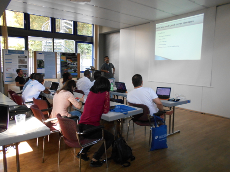
Poster presentations of the participants (photo by G. Osiakwan)
On Thursday, the students had the chance to present their posters on current research projects or the ecotoxicological situation in their home countries. On Friday, James Dabrowski from the Council for Scientific and Industrial Research (CSIR) in South Africa held a lecture on Risk assessment and data availability in a developing country. This module presented real situations in developing countries using South Africa as a case study. The students learnt a specific approach for risk assessment, the development of exposure maps and possible classification of pesticides in risk categories to set priorities in the subsequent monitoring and risk assessment. This was done by paying particular attention to the optimal allocation of the limited resources available in developing countries.
Over the week the students had the opportunity to participate in a few cultural experiences. Wednesday afternoon we went to a wine and grape juice tasting in the vineyards and the winery. Over the weekend we visited the beautiful city of Heidelberg and participated in a rainy Rhine river cruise with the focus on the wildlife and the history on the Rhine and alluvial forests. I think everybody enjoyed the cultural experiences and overall the weekend tours were quite relaxing.
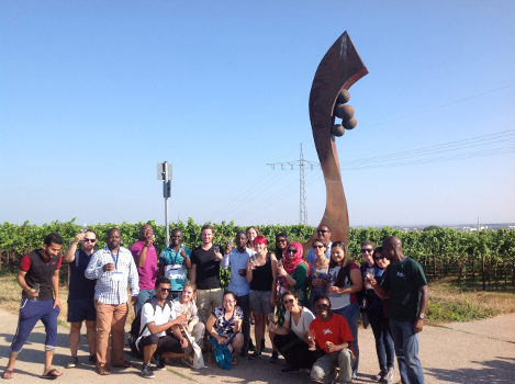
Wine and grape juice tasting in the vineyards (photo by A. Musana)
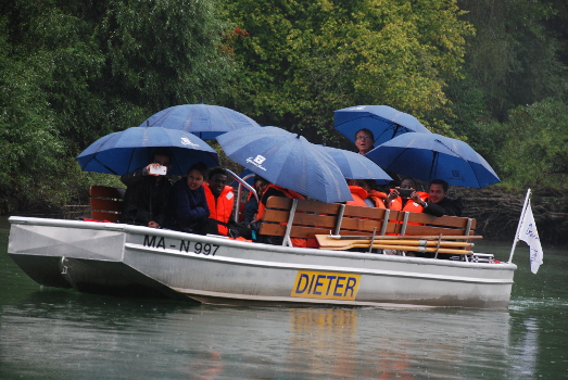
Boat trip on the River Rhine (photo by A. Lemessa)
In the second week of the Summer Academy the students were introduced to varying open source software applications such as R and GRASS GIS to use in spatial analyses and mapping by Ralf Schäfer and Avit Bhowmik from the University of Koblenz-Landau and Stockholm University, respectively. Thereby, spatial analyses and simplified pesticide exposure maps for regions with data scarcity were introduced. The students learnt to process free global satellite and ecological data and used this information to characterize chemical exposure risks. Given the limited availability of data in developing countries, a special emphasis was placed on spatio-temporal interpolation techniques that can be used to fill in gaps in the data. After this, the students learnt how to use open source software to conduct Health Risk Mapping.
On Wednesday we enjoyed an excursion to the Palatinate Forest with a great view from the castle “Burg Landeck”.
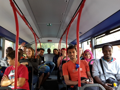
Bus trip to the castle “Burg Landeck” (photo by M. Wieczorek)
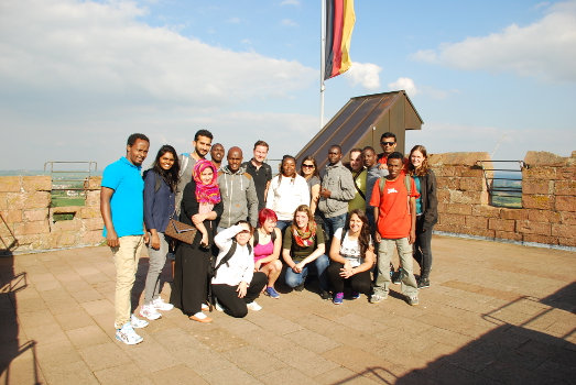
On the highest tower of castle “Burg Landeck” (photo by A. Lemessa)
Later in the week, the theoretical basics on the topics of agricultural practice and modelling of pesticide contamination were presented by Engelbert Niehaus, Jörg Rapp, and Melanie Platz and then practiced. After, the students were able to create contamination maps using open-source software and relate them to other relevant variables such as population density or land use. The last day of the course combined the skills that the students had developed during the course and applied them to a real world situation: they had to practice specific approaches to risk assessment, to develop exposure maps and to classify pesticides in risk categories in order to set priorities in the subsequent monitoring and risk assessment in countries with limited monitoring resources.
After the hard work of two weeks, we celebrated with a nice BBQ. Some students prepared dishes from their home countries and at the end we had an outdoor dance party with a colorful music mixture. We spent a great time with new dance moves from different countries.
Sunday and Monday everyone headed off in their own directions, some either to explore a little more of Europe and others headed back to their home countries. All in all the students said they enjoyed their time in Germany and learnt a lot to take back with them.
Thanks to all participants, lecturers, and my helpers for an awesome time and lots of memories!